
It was the year 2019 when we initially planned to summit the highest peak of the country, Mt. Apo. Unfortunately, due to the seismic activities detected, the plan was deferred. So, we opted to climb the nearby mountains of the neighboring province, Mt. Kalatungan and Lumpanag Peak which are both sitting next to each other. Mt. Kalatungan is one of the top five highest peaks measured in the Philippines. The climb was fulfilling and the experience was wonderful, but deep down we know that summiting the highest peak of the country would be a different level of experience and sense of achievement. So we swore to regroup and continue our quest to summit Mt. Apo once everything is already stable and clear.
The year 2020 came and the pandemic struck. COVID-19 affected almost everything including, first of all, global tourism. The pandemic was such a bummer and it would take a whole lot of time detailing the bland events during the entire community quarantine. So, our plan was once again deferred. By the year 2021, everything is starting to get ease. Vaccination efforts started to ramp up. Cross borders started to loosen up and tourism started reopening. Late 2021 when we received the good news. We can now climb Mt. Apo! Hurrah! We then arranged the paperwork and booked flights to Davao City.
Before I start laying out my experience, let me give a short introduction about Mt. Apo. Mt. Apo is a dormant volcano located on the southern island of the Philippines, Mindanao. It is the highest-scaled mountain in the country and can be seen from an airplane when approaching landing or departing from Davao City. For more details, you can visit its Wikipedia page.
Months before our scheduled climb, we slowly started preparing everything. First and foremost, our flight tickets and some paperwork including registration forms, medical clearance, and permissions. Some of us started buying needed gears, either new or replacement of the old ones. As for me, I was deciding to buy a new tent and trekking bag, but my wallet says otherwise. I just bought a new rain cover for my 7-year-old trusty bag. I need a new rain cover since the old one does not have much of the water repellent agent anymore. For my tent, I still used my old one. I just replaced most of the seam tapes for water protection. I just invested my money in my new trekking shoes since my old one is already worn out.
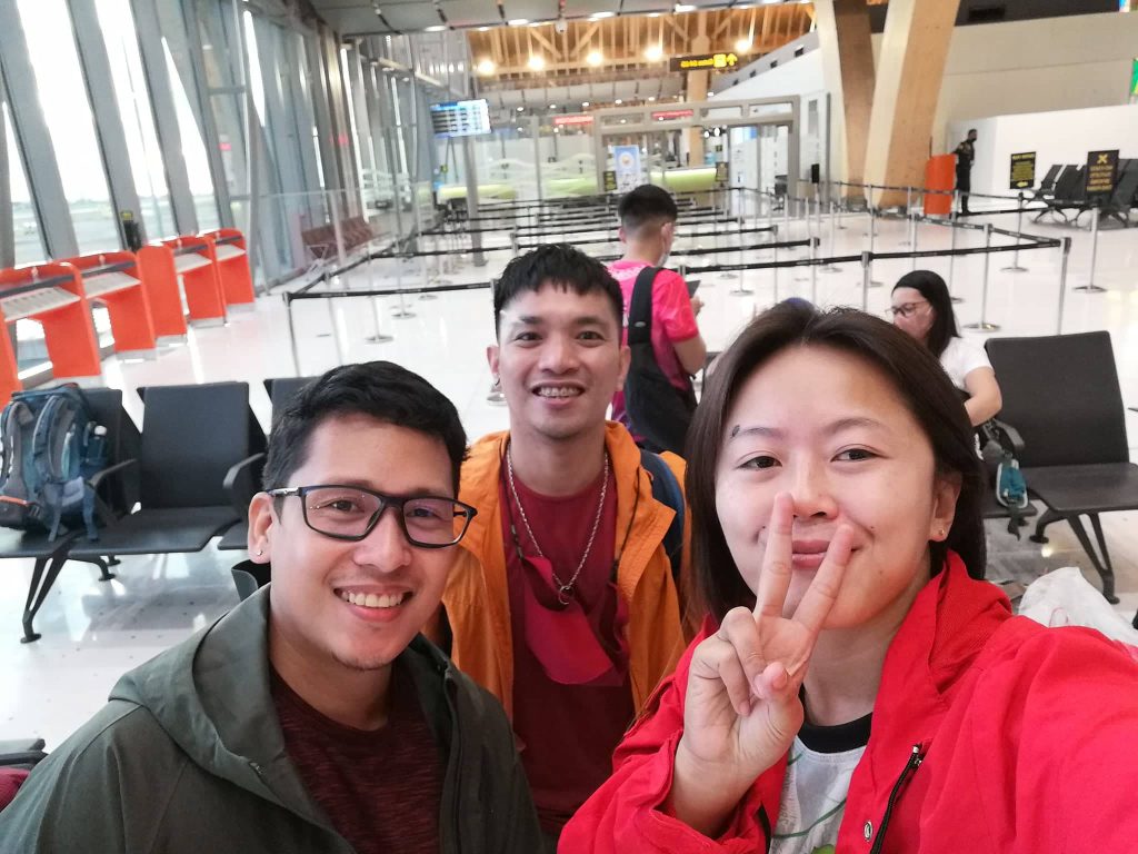
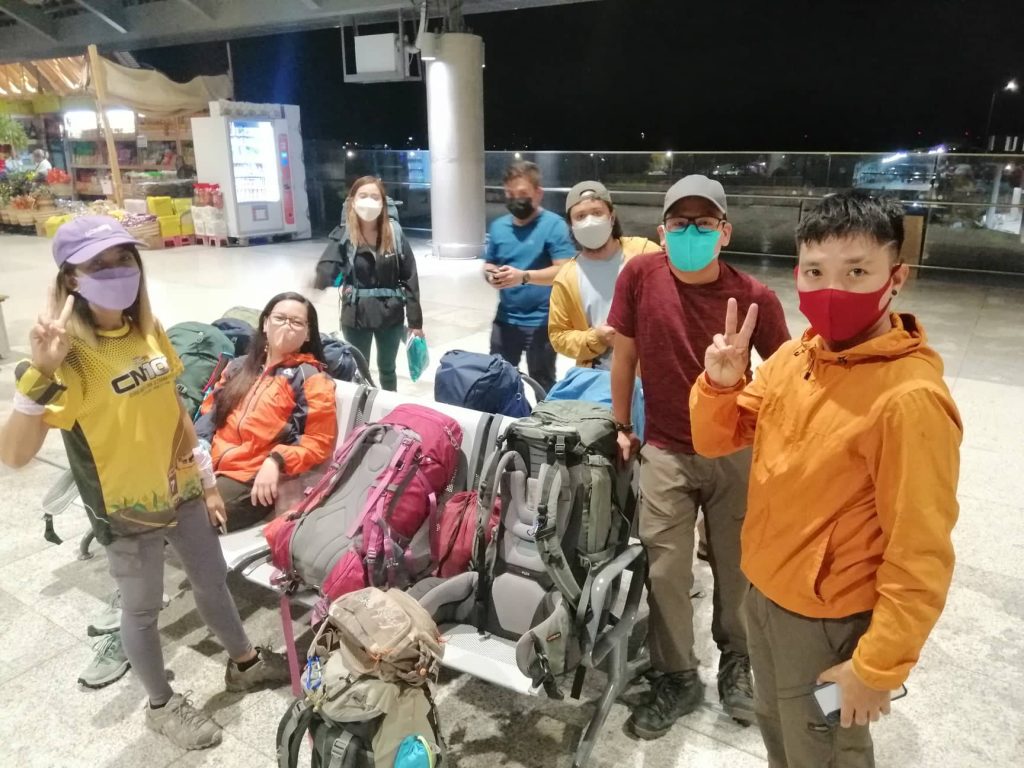
The day has finally arrived when we all be meeting at the airport for our flight to Davao City. Some of us are fresh from our work schedules, while others had their beauty rest. As for me, I just had a quick nap from my work schedule that ended around 12:30 AM, packed-up around 2:30AM, and departed for the airport by 3AM for our 5:30AM boarding time. Most of the faces were familiar from our Mt. Kalatungan climb. There were additional faces and a few missing. Regardless, my heart is still filled with excitement as Mt. Apo will just be a few hours away.

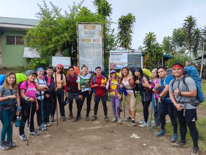
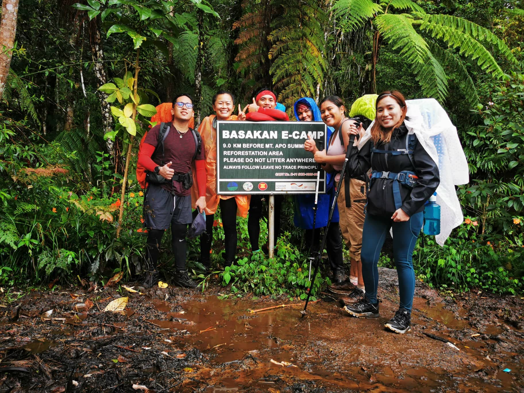
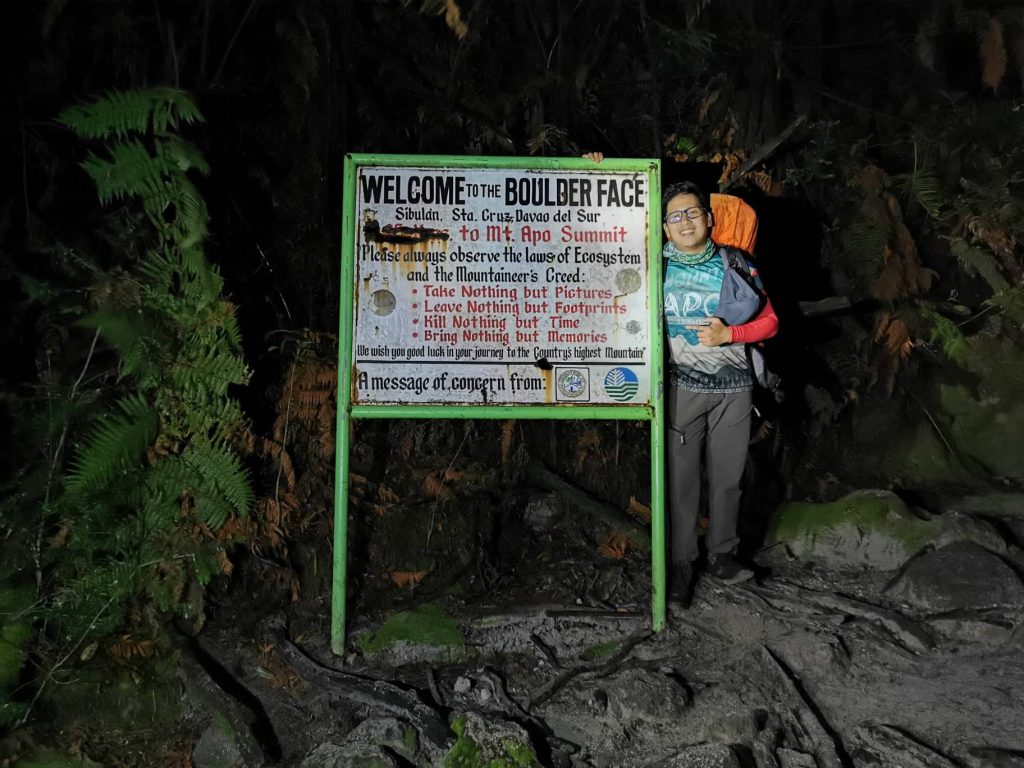
We arrived at Davao City around 7AM and were picked up by our chartered van around 8:30AM for our departure to the municipality of Santa Cruz where we’ll start our trek. Upon arriving, we started our trek towards the jump-off area where “Kuya Babo”, our main guide and coordinator, held his orientation. For this climb, we will be following the Santa Cruz circuit trail.

Heading just to the jump-off area already took a bit of my gas. Well, that’s what you get when you don’t have enough physical preparation before the climb. At the jump-off area, we finalized our preparation and took our lunch. Some of us hired porters for 1,000 pesos/day for easier ascend especially those with physical disadvantages. Thinking about the cost made me think that I can just go on without one.
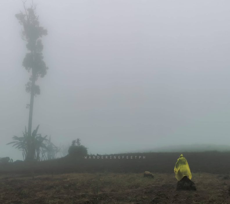
We started our ascend to our first camp around 1:40PM. It was estimated that we’ll arrive around 6PM. The sky was gloomily suggesting a downpour and, an hour later, it did. It was like a reminisce of our Mt. Kalatungan climb where we were welcomed by heavy rain. They managed to get their raincoats and I did not. First of all, I purposely did not bring any raincoats. I am not suggesting not to bring one, but personally, ascending with raincoats on just feels uncomfortable. It just traps the body heat making me sweat more. I prefer to get soaking wet while trekking to balance my body heat and the cooling of the rain, thus making me feel less dehydrated.

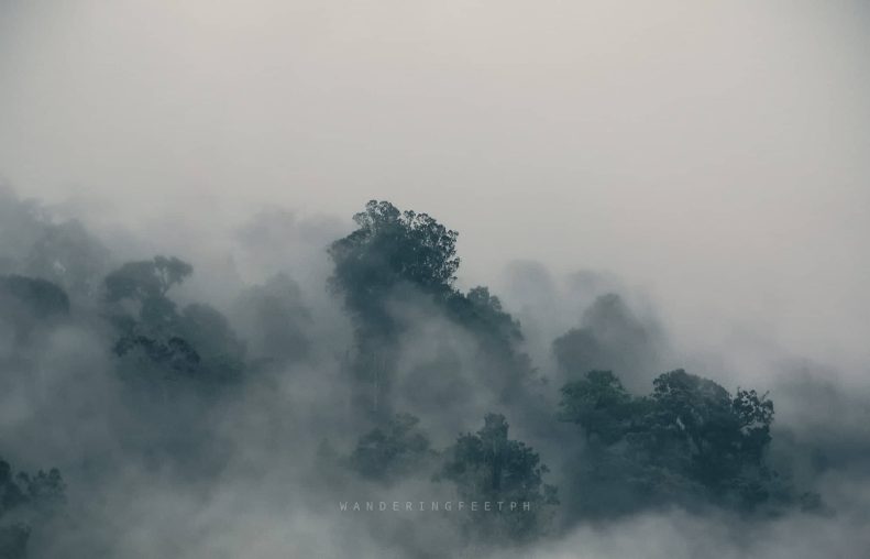
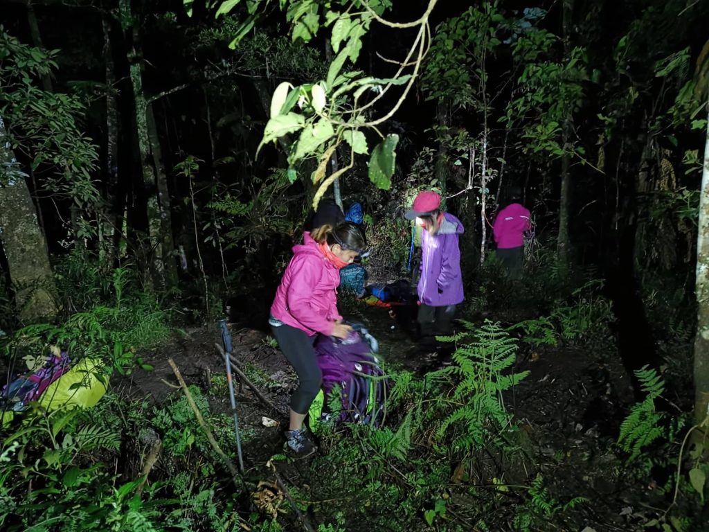
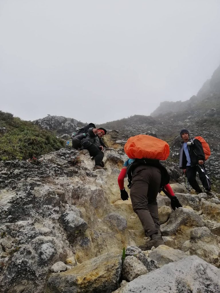
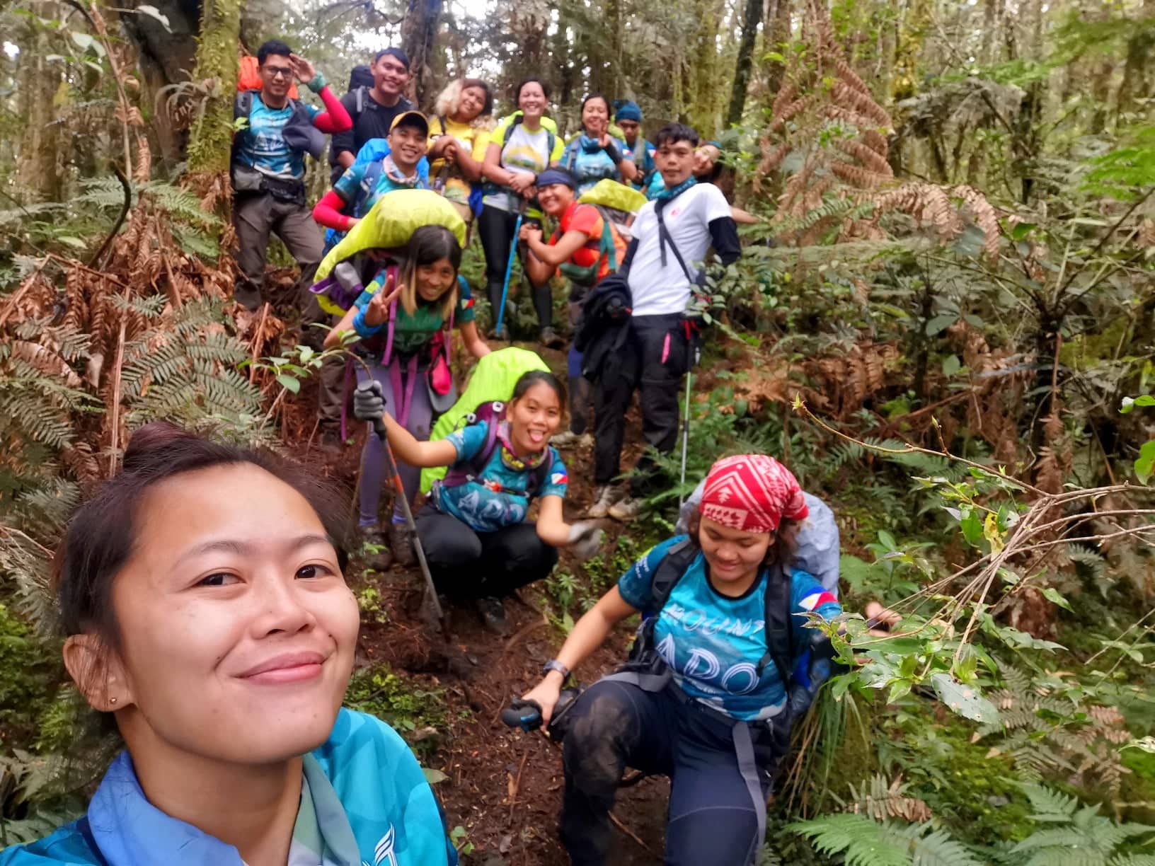
Heading to our first camp, the forest was thick with trails of mist and fog from time to time. The trail was established and muddy. There are few signages and markings along the way. I chose to be at the tail end of the group since I wanted to take my time and photograph whatever I can along the forest trail.
It was already dark when we arrived at Tinikaran Campsite 1. Pitching our tents was a challenge since the ground was nearly mud, and the area is too cramped with other climbers pitching their tents as well. A makeshift for the ground is to find broad leaves as a layer between the ground and the tent groundsheet. An important suggestion to consider is to bring insulation pads. Thankfully, I was able to borrow one from my friend, Manilyn, days before. She also climbed Mt. Apo just months before.
As the darkness swole, the campsite started dropping its temperature. I hurriedly changed to my dry clothes to keep myself warm. Every climb, it really is important to observe waterproofing to keep things inside the bag dry. Especially the clothes. It was still early, around 7PM but the coldness was crazy. I did not bother getting outside anymore to get my dinner, I just asked for a hot soup and scooted down under my sleeping bag for a rest since we have an early call the following day for our summit assault.
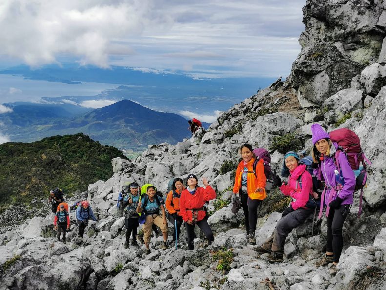
It was around 2AM and everybody started breaking camp and preparing for the assault. All of our tents were soaking wet from the moisture thus adding weight to our backpacks. There was a small water source nearby the campsite where some of us fetched for the assault. We departed for the assault around 2:45AM. It is essential to not get too far behind the group since the trail has multiple forks and it was still dark. We arrived at the boulder face area just a few minutes before sunrise at around 5AM.

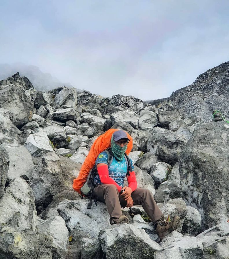
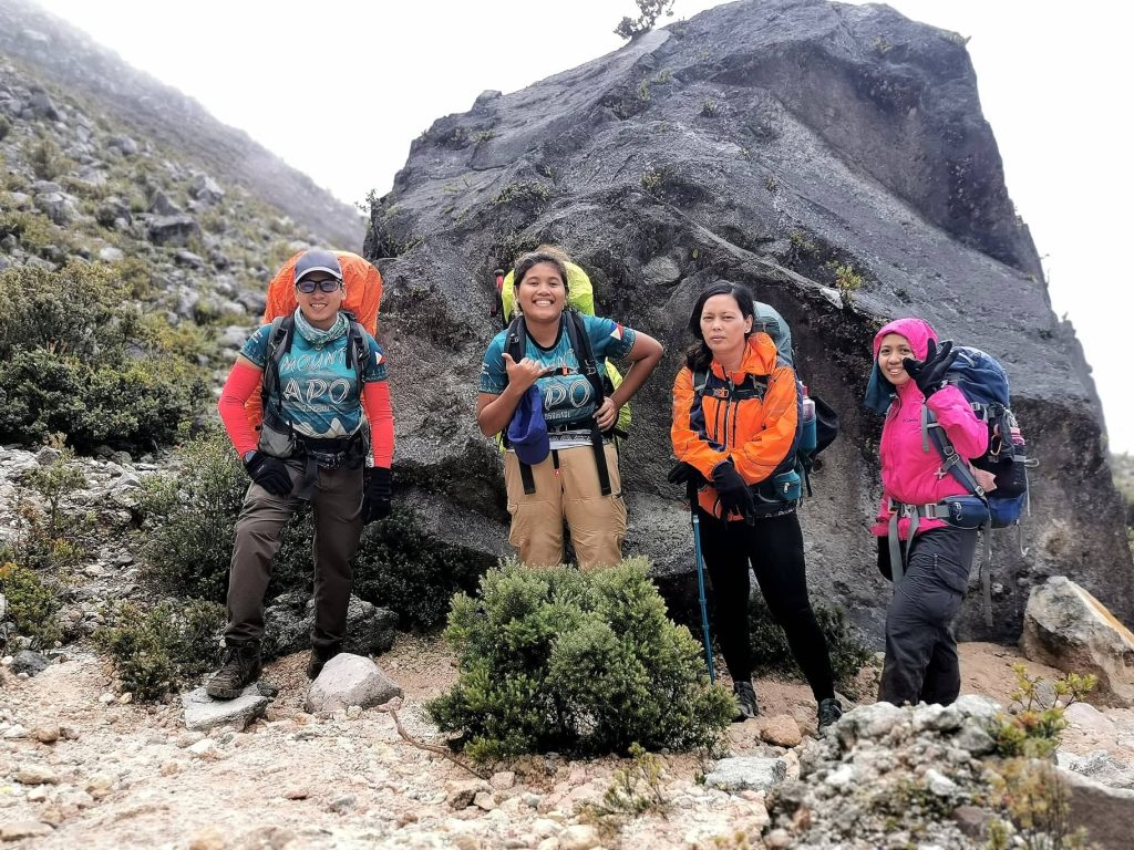
At the foot of the boulders area, we took a rest and regained as much strength as we can in order to face the notorious boulders area of the mountain. From what I heard from all of my friends who already climbed the mountain, the boulder’s area is notoriously known to deplete your energy tank. That is why we took our time to rest for a while and took several photos to enjoy the moment.
It was already 6AM when I began my assault. Some members of the group have already started their ascent but I decided to take the sweeper role so as to not delay the other members when I take several stops when taking photos. The weather was good. There was no hint of any rain coming and the sun started trickling its rays against the white boulders of the mountain. There were traces of sulfur on the ground and even so on the air as the dormant volcano spews sulfuric clouds throughout its vents. Everyone was scrambling from one boulder to the next. There was no definite path and you’ll get to use all your limbs to pull yourself from one rock to the other. Personally, this section was the most exhausting. I was challenged especially now that my bag is heavier due to my wet tent.
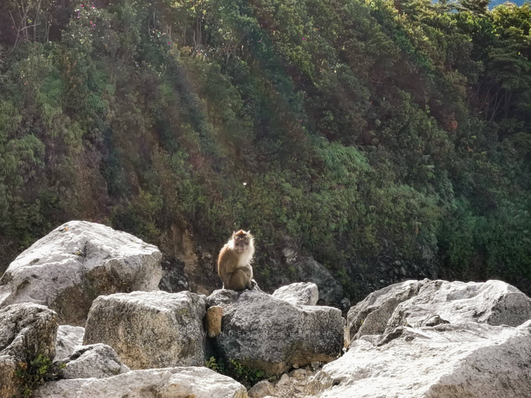
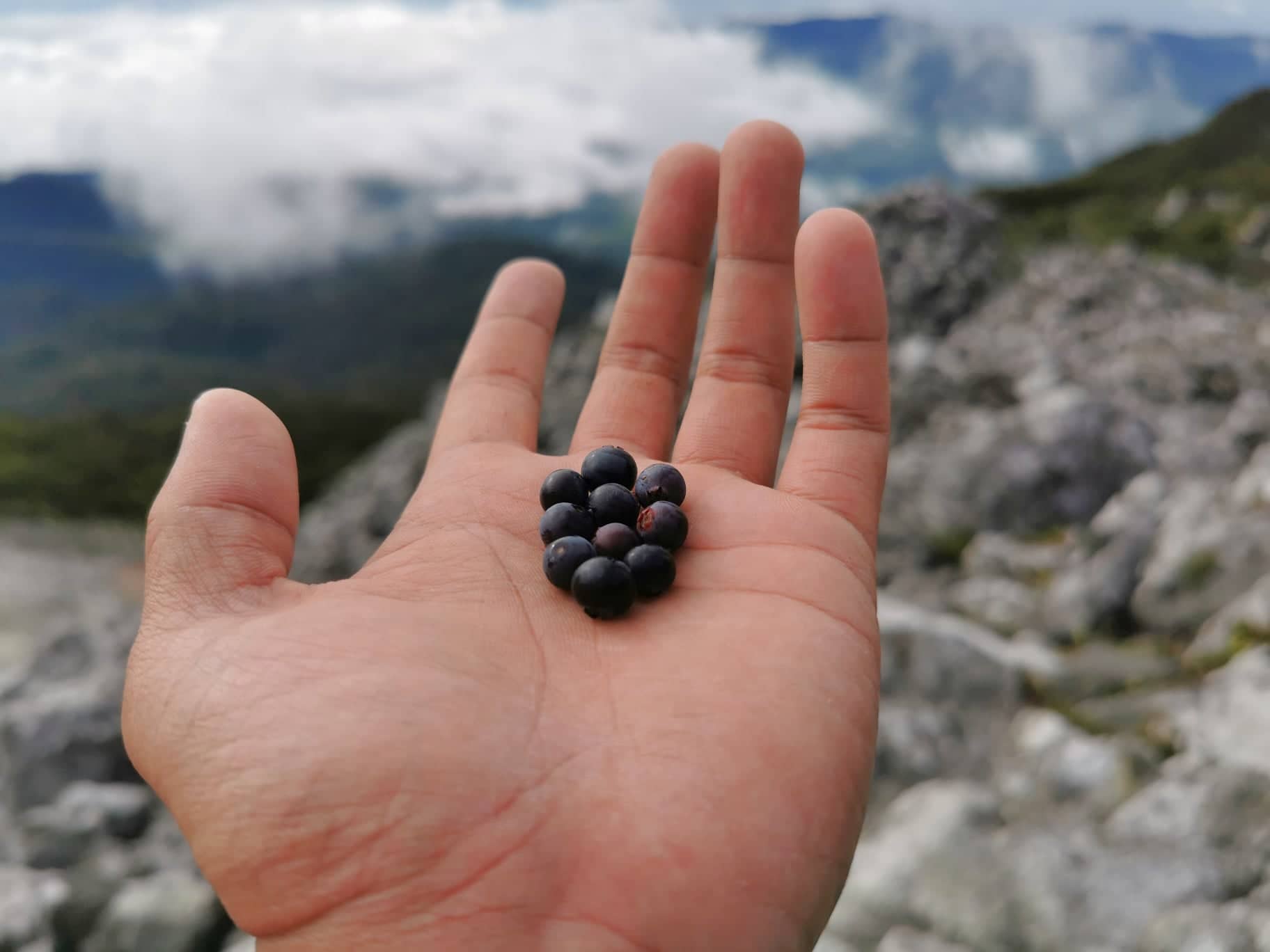
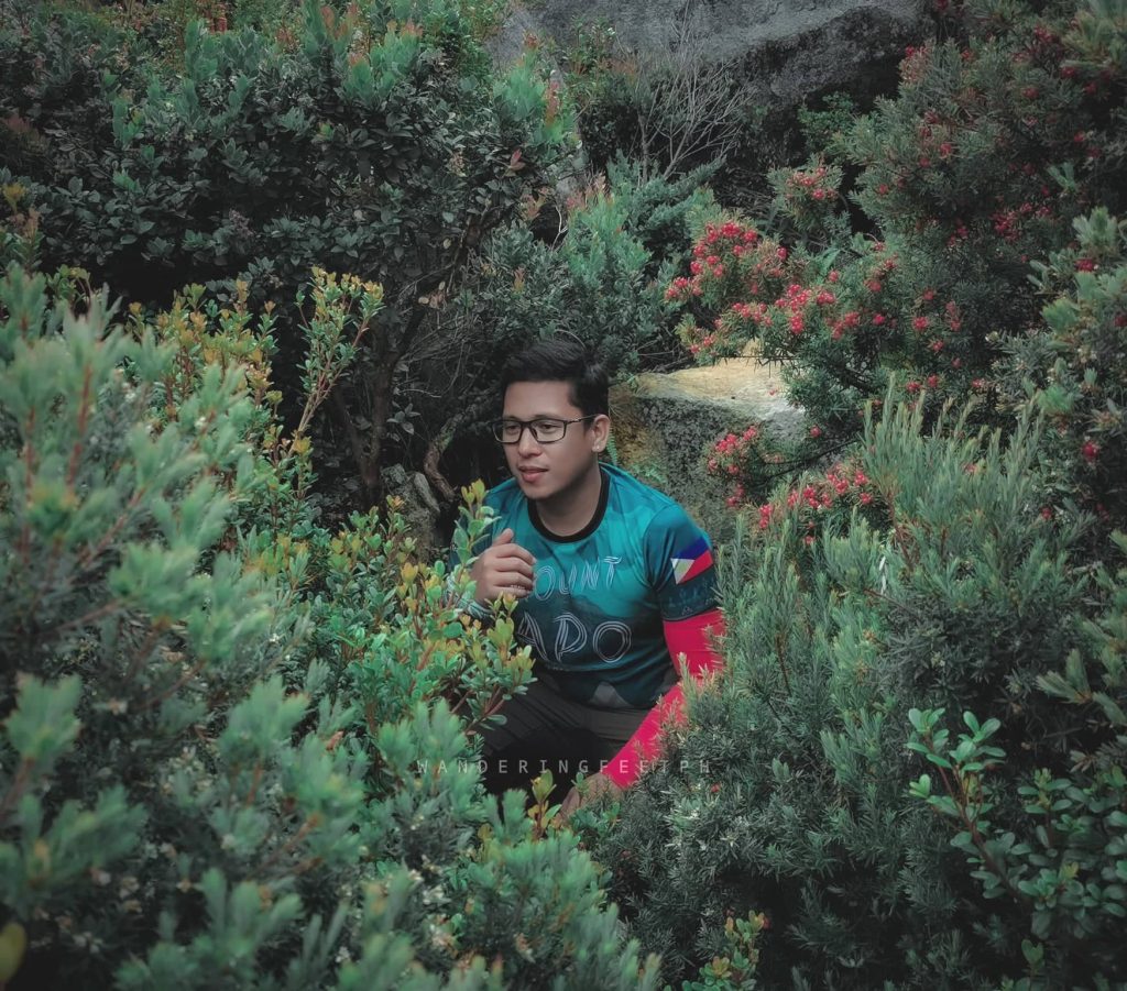
Wild berries grow all around the boulder area and it seems like the wild monkeys came out for their harvest.
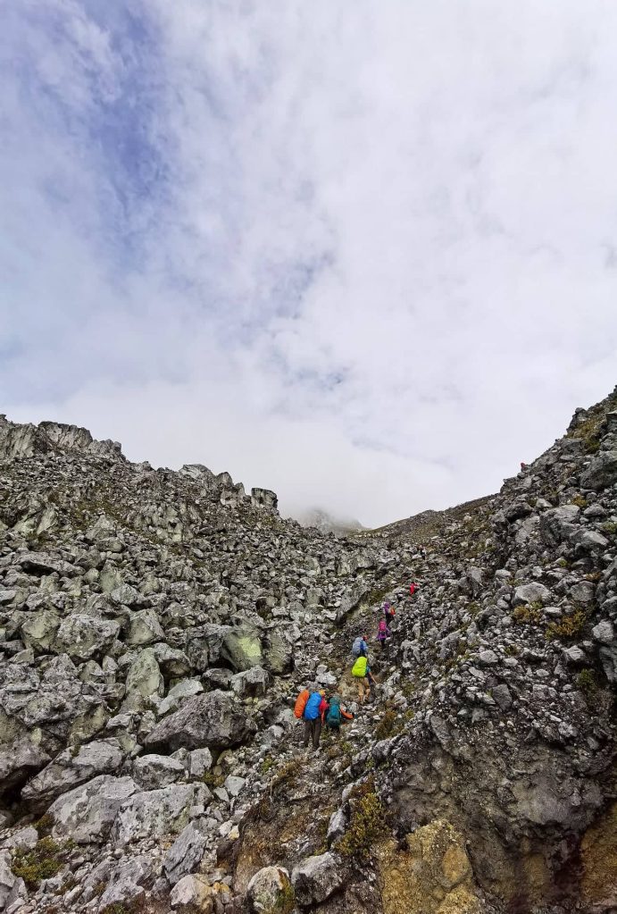
As the day progressed, the sun started to rise to its peak, but the mantle of clouds and fog gave us enough protection. We can’t feel the heat as well, since it’s getting colder at the top. It is advisable to wear sunscreen as an extra layer of protection for your skin. Boulder from boulder, we pushed our limits to get to the peak. It took us several stops to catch our breaths. We only had a long break just to have our breakfast. It was hard and exhausting, but still, the view gave us a better hope of what else we can witness at the summit. From the boulders area alone, the scenic view was not beautiful. It was GLORIOUS!

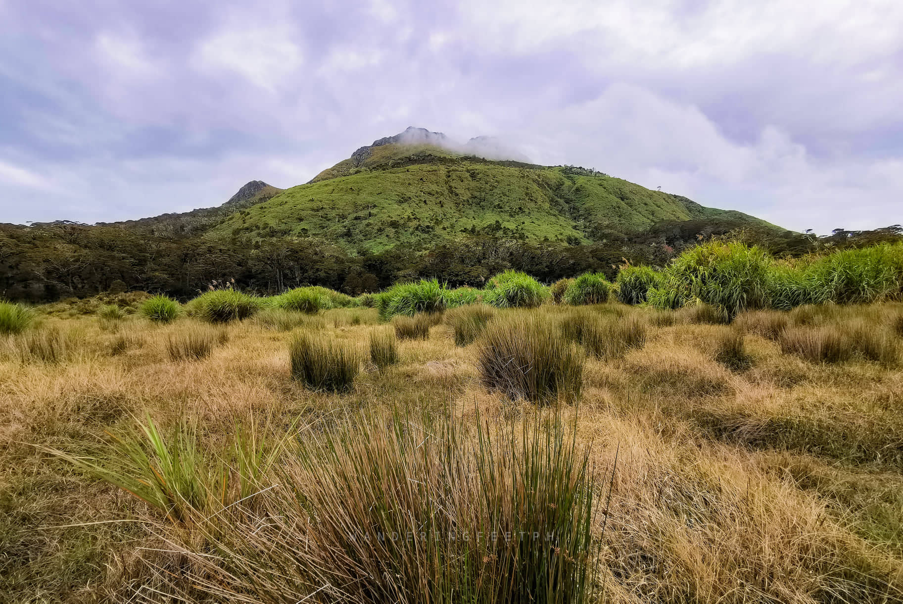
Three hours passed and I was able to catch up with the group at the area called White Sand Emergency Camp. It was located just a few meters below the mountain’s peak. We regrouped and regained strength before the final assault towards the first peak of the mountain. FYI, the mountain has multiple peaks and there are 3 known peaks that are usually climbed by mountaineers.

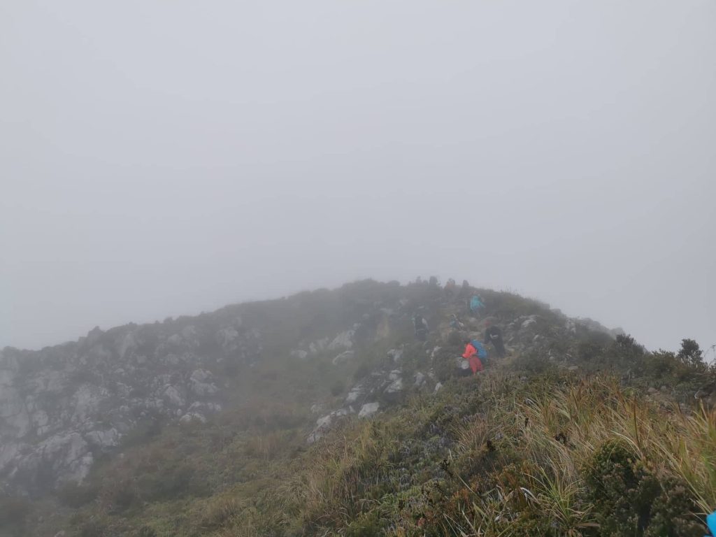
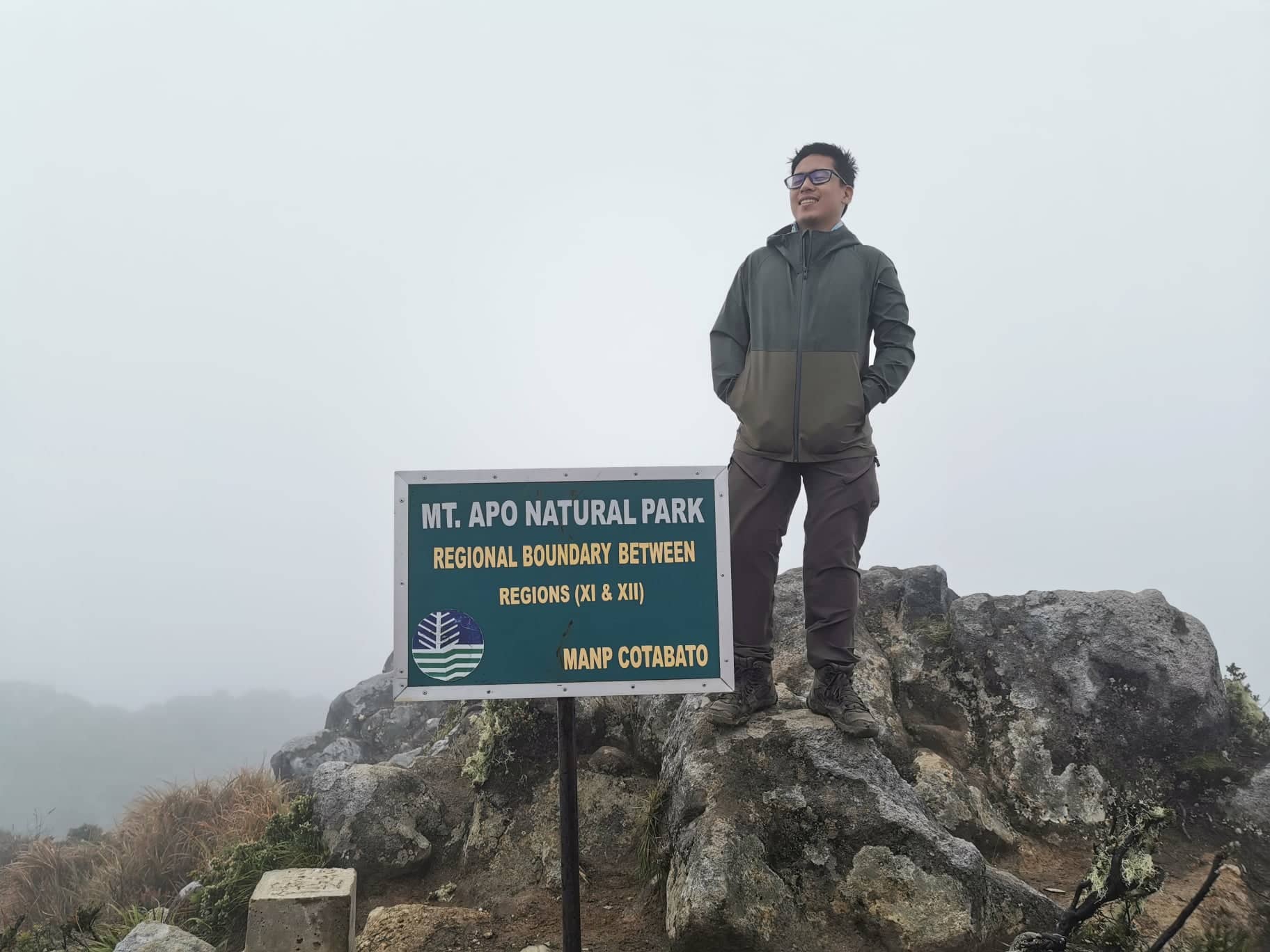
At the foot heading towards the first peak converges the Santa Cruz and Kapatagan trail. There we were able to meet other climbers from another trail. The assault heading to the crater lake was pretty elevated with at least 45° steepness. The coldness of the air increased as we gained elevation. The entire area was thickly covered by fog and there was no hint of a clearing.
It took us around an hour to arrive at the crater lake. The lake was nearly invisible due to the thick fog. From time to time, a glimpse of the rippling lake water can be seen, but not the entire lake. Nearest to the crater lake is Davao Peak which is another 10-15 minutes climb. Almost zero visibility, but we still pursued. We were welcomed by a strong gust of very cold wind at the peak. It was so hard to take a decent photo because it was freezing and the wind was just too strong. I was even afraid to pull out my camera phone thinking that the wind might blow it away from my hand.
We did not stay too long at the first peak as we still have two more peaks to climb. We traversed right away to the second peak which they call “The Mother Peak“.
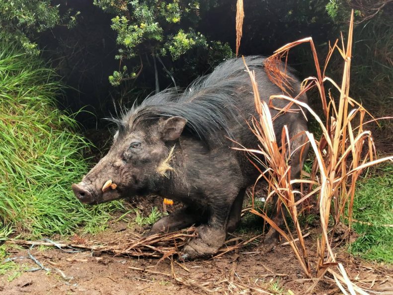
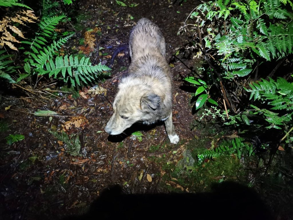
As we descend from the second peak, we witnessed the appearance of the lonely Philippine Warty Pig of Mt. Apo. The pig was surrounded by people as if like a celebrity. Some of the hikers fed the pig with rice and I can also see some chicken bones. I am not sure if the ones who fed the pig were local guides or just visitors, but I think it isn’t allowed to feed the wild animal. It isn’t a fault to take a photo with the animal as long as you observe some distance. The animal is quite territorial. One hiker luckily saved his arm from the animal as it tried biting him when he was approaching really close to it. Thankfully, it was just his jacket that got ripped. *sigh*. We don’t want to witness accidents right?
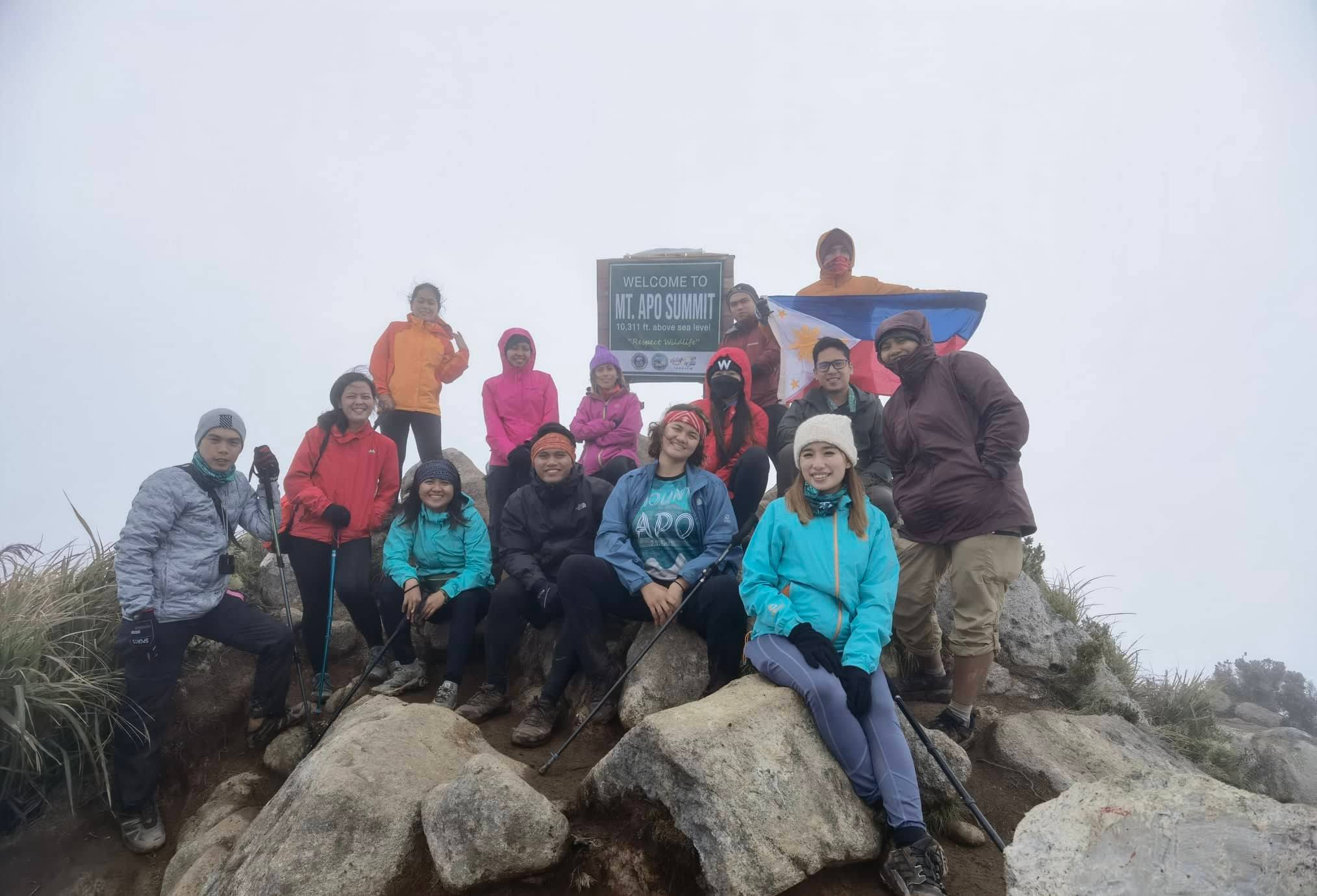
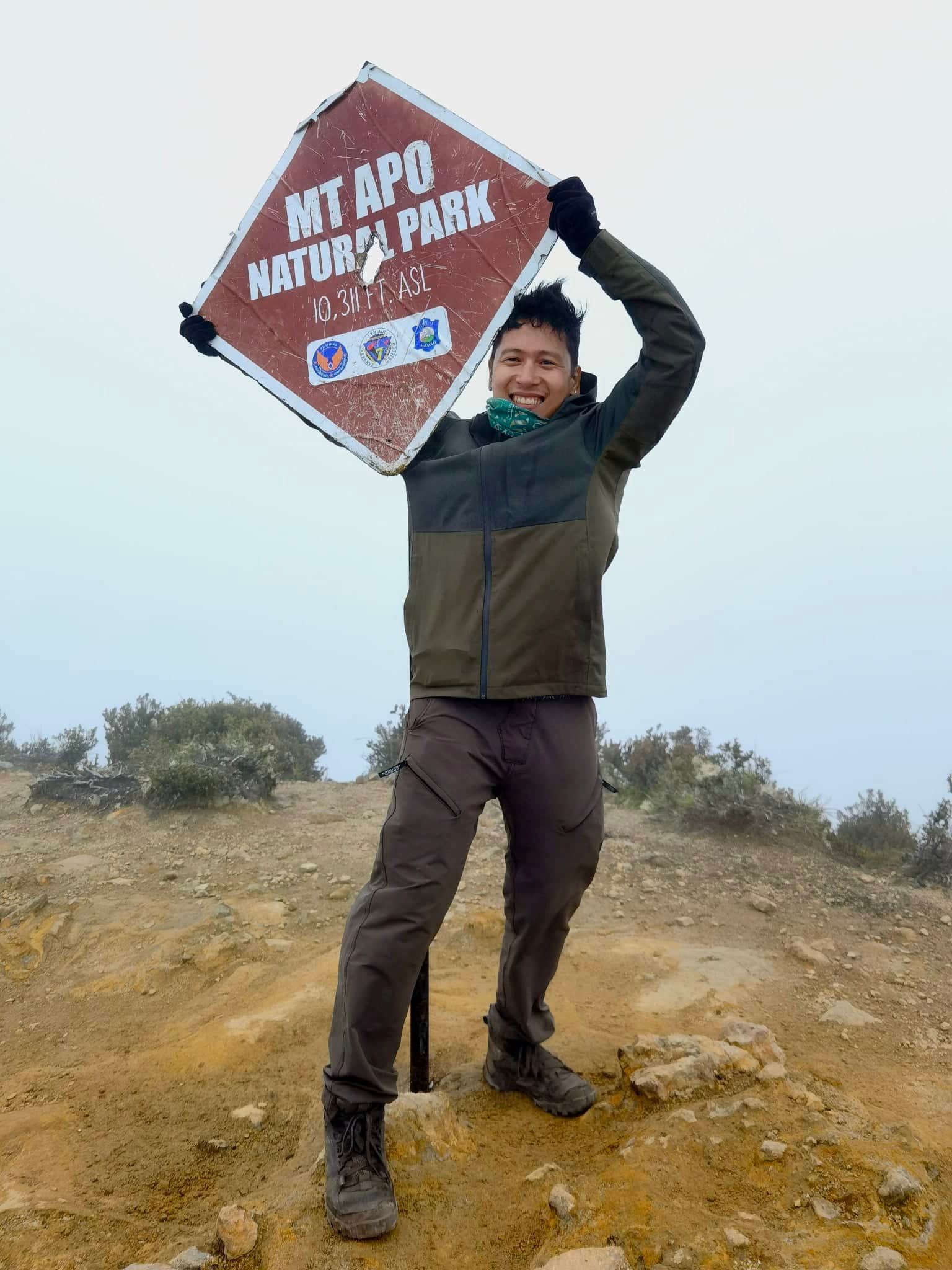
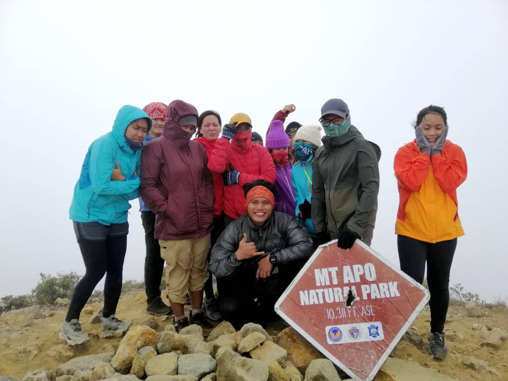
We took our lunch at the resting area before assaulting the last peak which is the “Kapatagan Peak“. The peak has signage indicating the measured height of the mountain. We did not spend a lot of time at the peak as there are other climbers queueing to have their photos taken as well.
It was unfortunate though that throughout our stay at the highest point of the country, we were not blessed with a clearing. Legend says that, for you to get a clearing at the top, you should be respectful of the mountain’s peace. Maybe that explains our experience, but I don’t know. There were really plenty of climbers that day. There were groups that are very loud. They were shouting and blasting their speakers with music as if in a bar. I mean, I can’t blame their excitement but I wish the organizers of the group could have given them an orientation to at least respect the mountain and the peace. Other people are there to experience nature’s raw serenity. There really are different kinds of climbers and my personally least liked are those trying to extend their bar house session in the mountains. Blasting their music and shouting as if everyone is trying to party. Dude, there is a proper place for you. Go to your favorite disco bar!
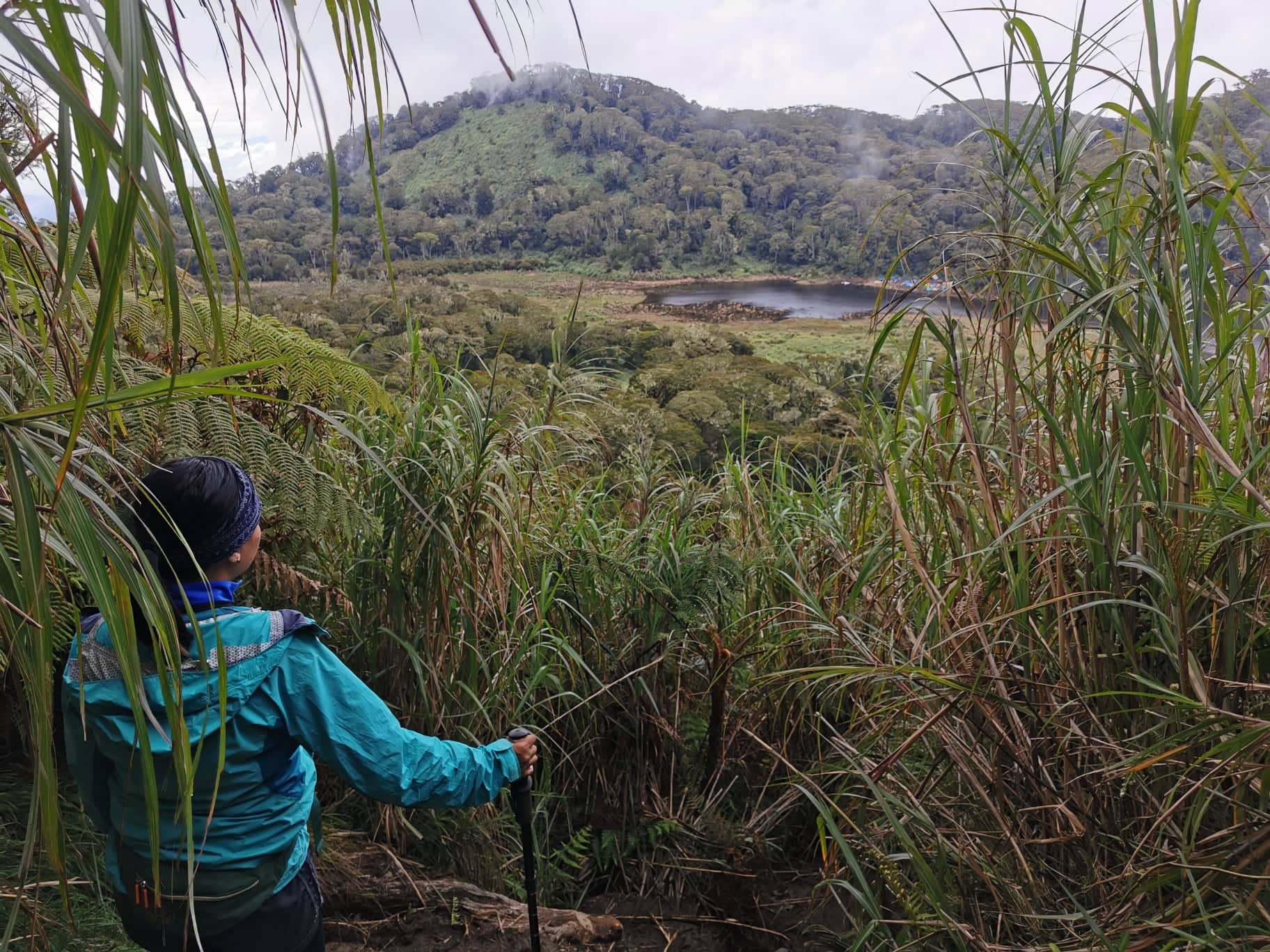
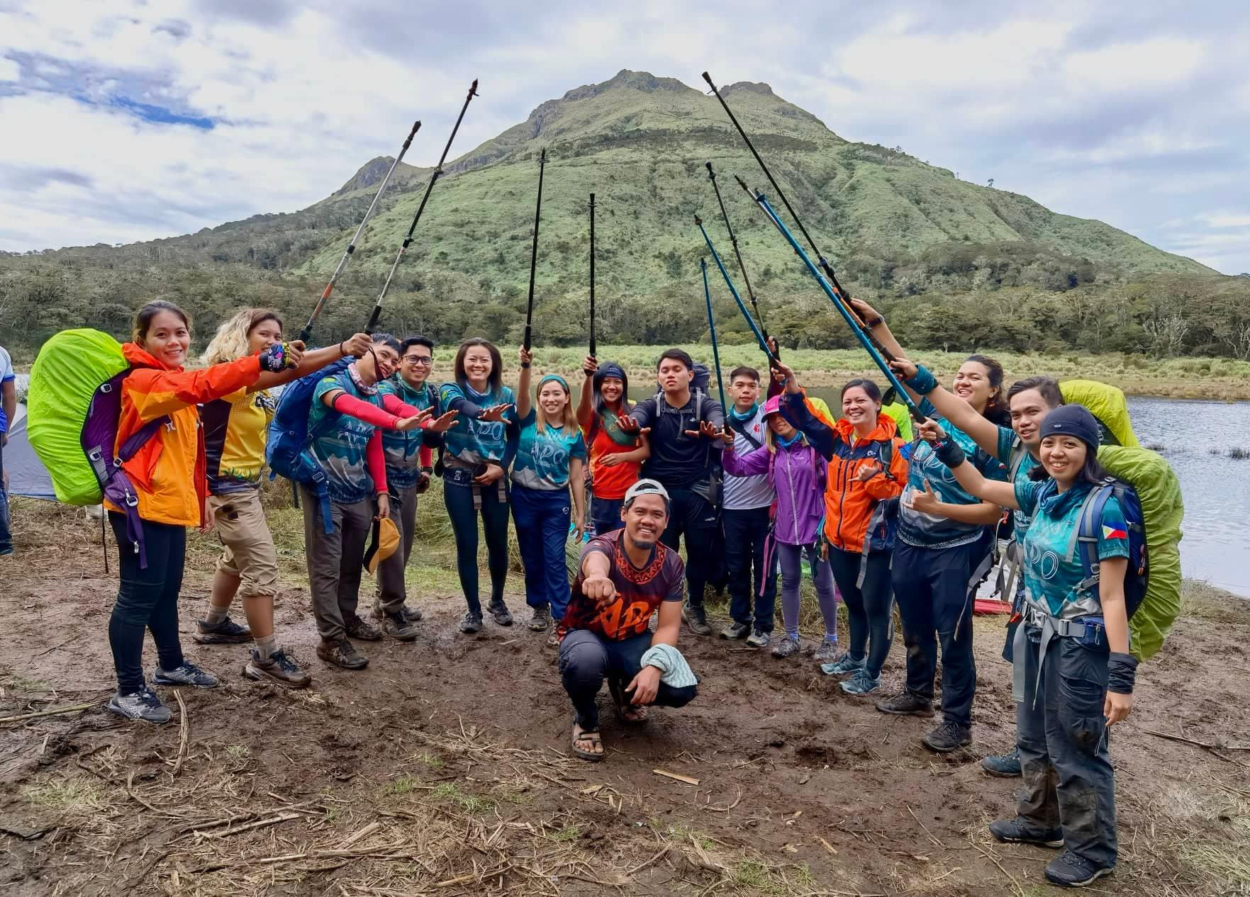
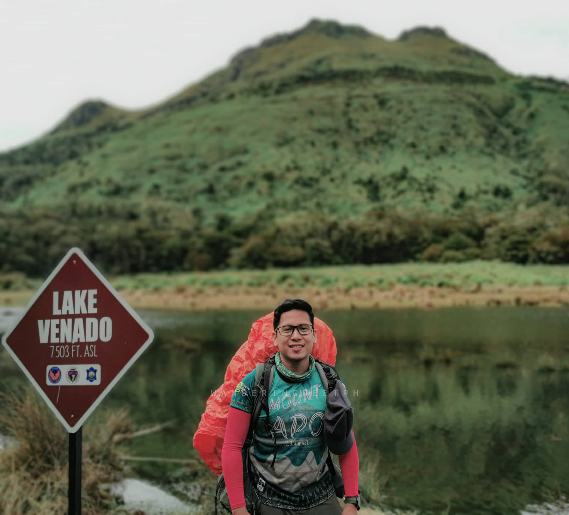
Anyway, right after we descended from the last peak, we headed right away down to Lake Venado where we will be pitching our tents to spend the night. I must say, the trail is on another level. Muddy, slippery, and steep. When I say muddy, it really is muddy like there are areas where it is more like a puddle of water than solid ground. There are a few small branches and plants you can hold on to, but mostly, the trail is surrounded by tall grass. Getting down was quite a challenge honestly. So tap your back if you got down to the lake successfully without a single slip. We managed to exit the trail within an hour and a half timeframe. Tips: “Trust your legs and your knees. Land on the area where there is grass as it grips more than the slippery mud. Skip trekking poles as it hinders you from grabbing branches, roots, and grass when you slip. Lastly, hire a porter for easier and worry-free descent.”
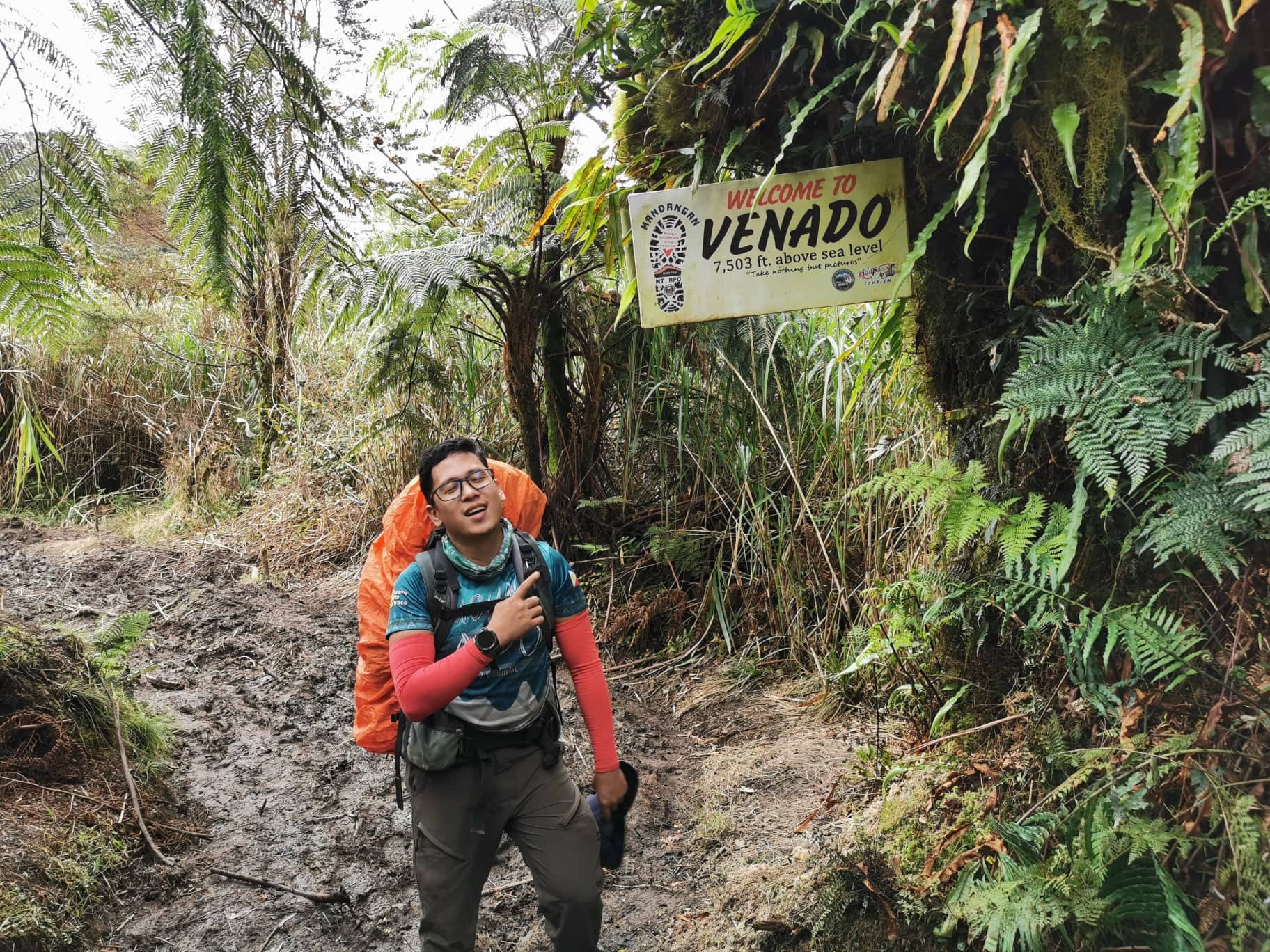
It was already afternoon at around 3PM when we arrived at Lake Venado. We then pitched our tent and changed our clothes. I took a nap while waiting for the others to arrive at the campsite. I woke up to the call for dinner and everyone had already pitched their tents and some even managed to get a shower. The campsite at Lake Venado already has potable water, decent sink areas, gender-separated toilets, and shower rooms. If you can manage to endure the cold water, then you can take a good shower, and that is not my case. I just can’t stand anything cold.
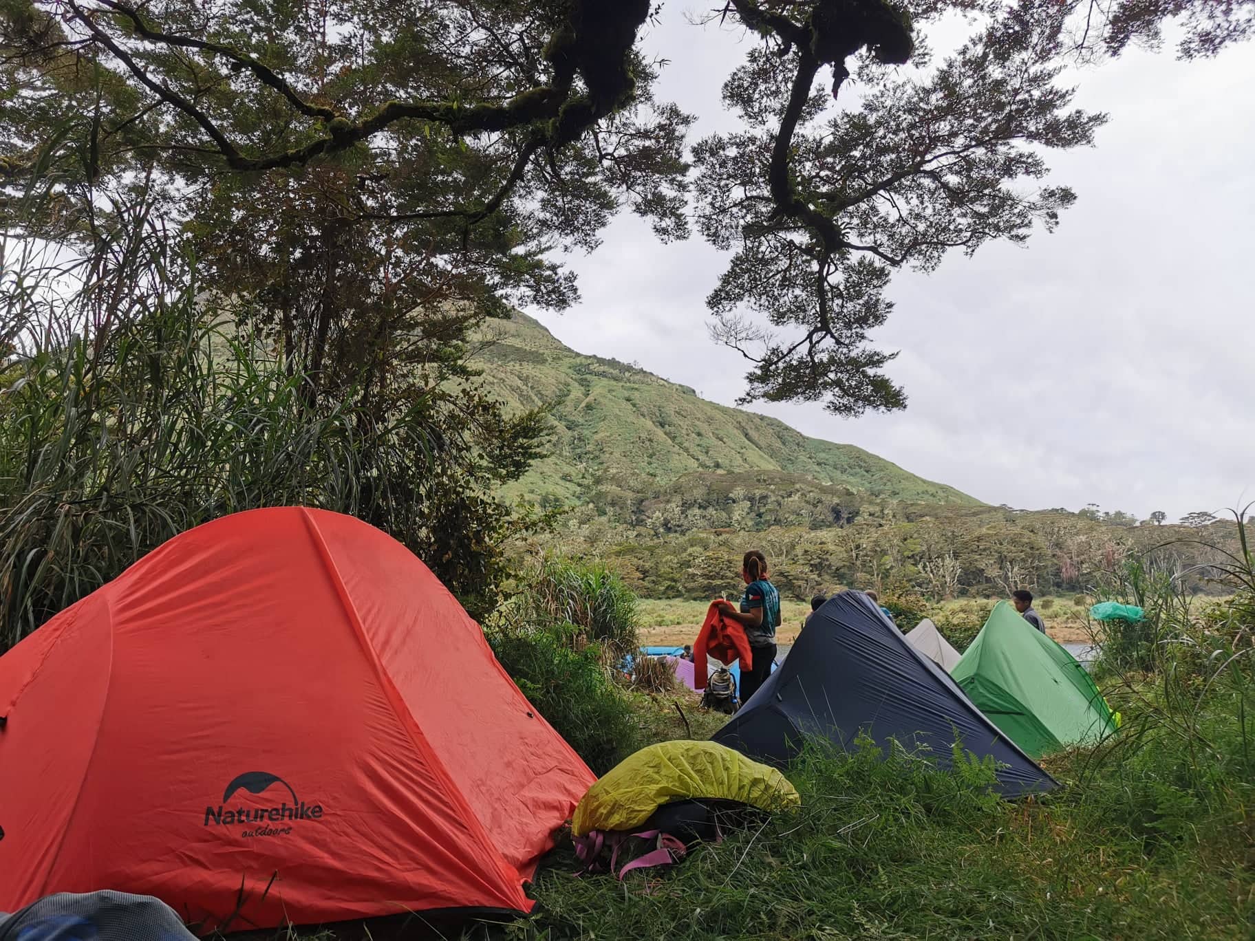
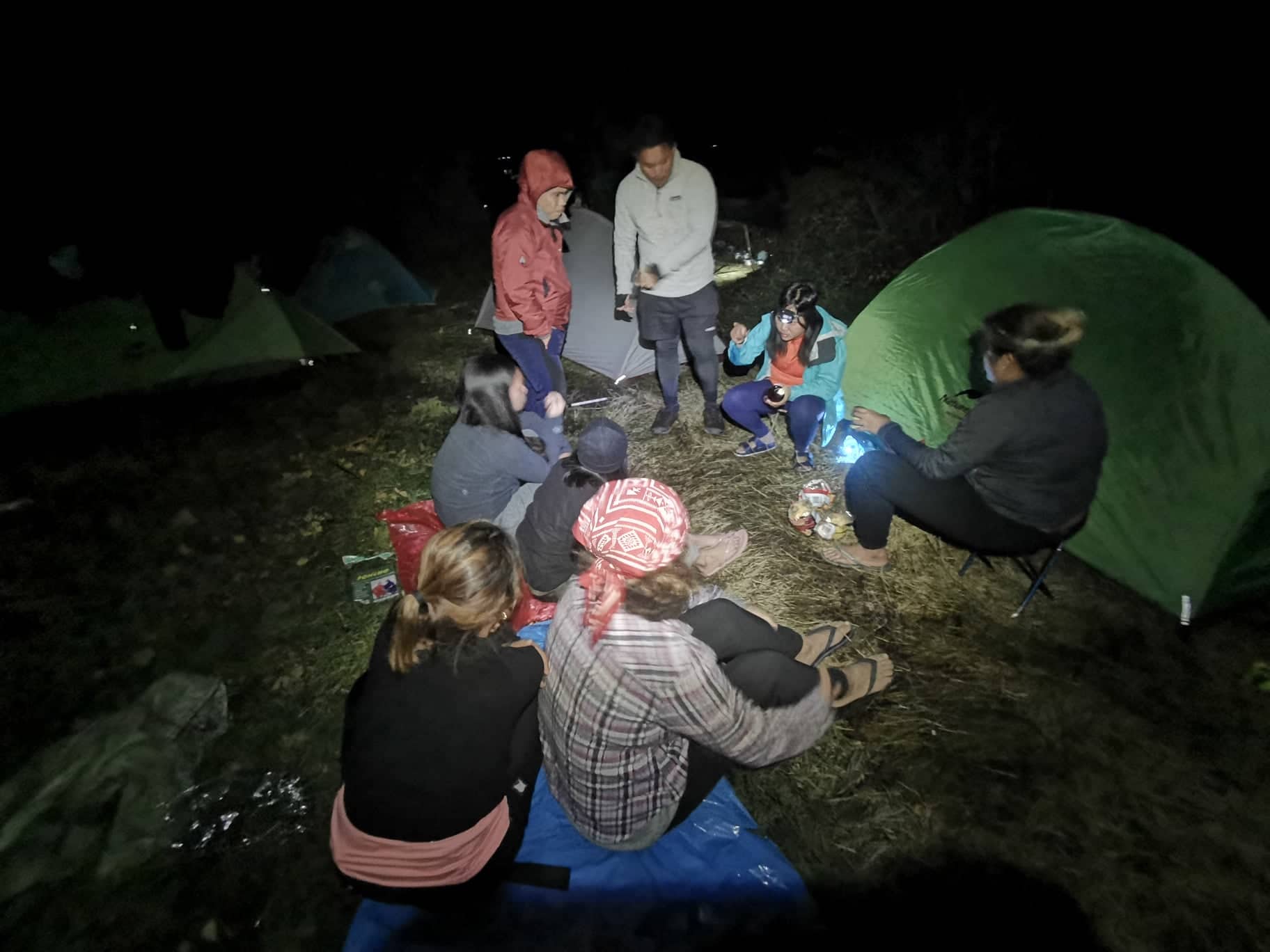
After our dinner, we had our group socials where we shared several laughs over a bottle of rum just to warm the night a little.

One of my goals in Mt. Apo is to be able to photograph its silhouette with the Milky Way galaxy as its back draft. Of course, I should never miss it. Climbing Mt. Apo is a rare chance and opportunity. Even though I was too tipsy from our drinking session, I forced myself to get near the lake and capture the magnificent silhouette of the country’s highest peak. I wasn’t sure during that time if what I captured gave justice to the mountain’s beauty. I was drunk and my vision was somewhat blurry. It was just the morning after when I reviewed my photos that I was in awe to see the outcome. Not bad!
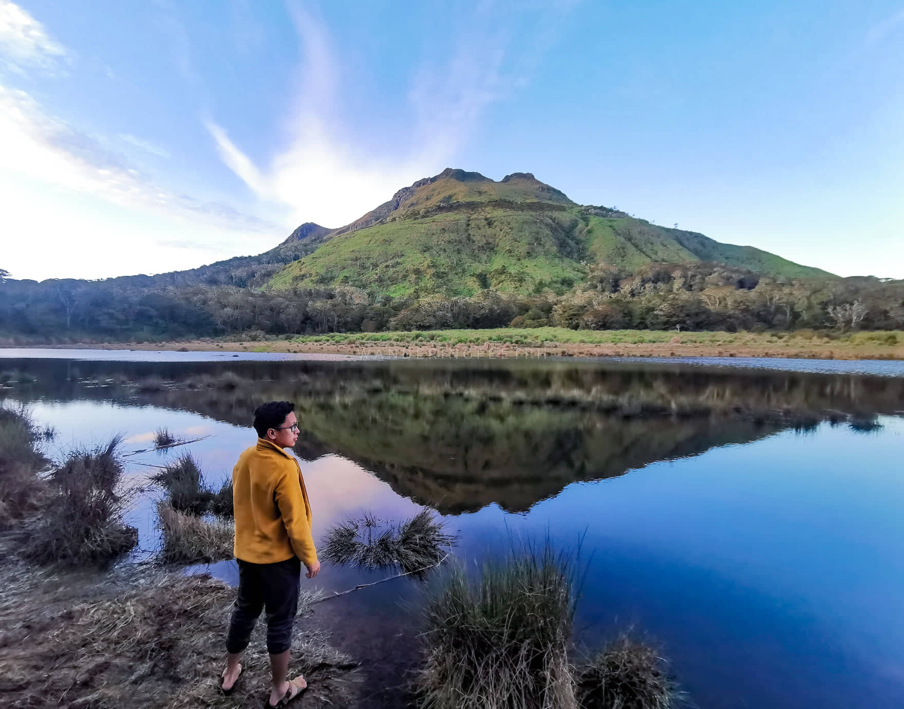
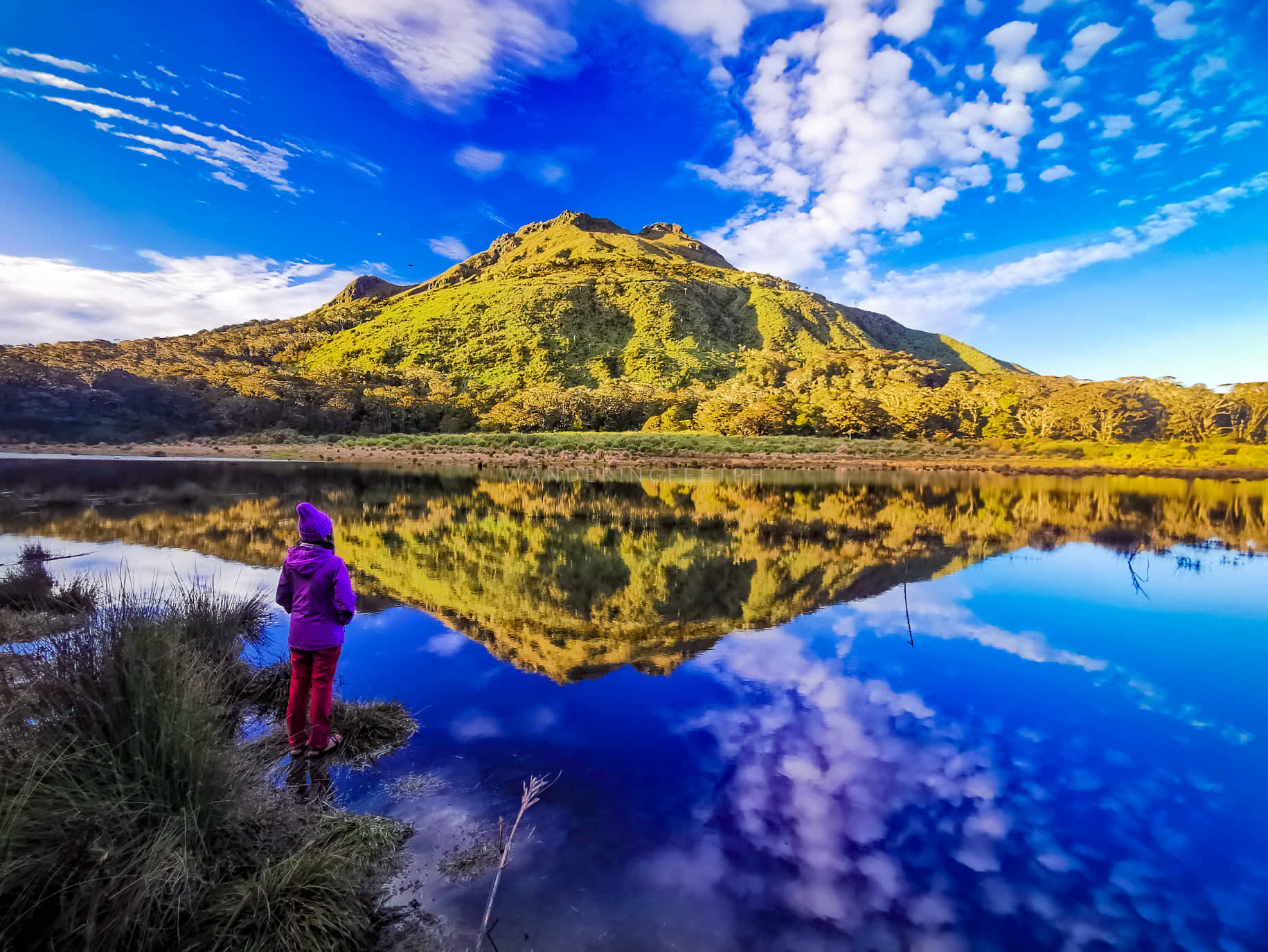
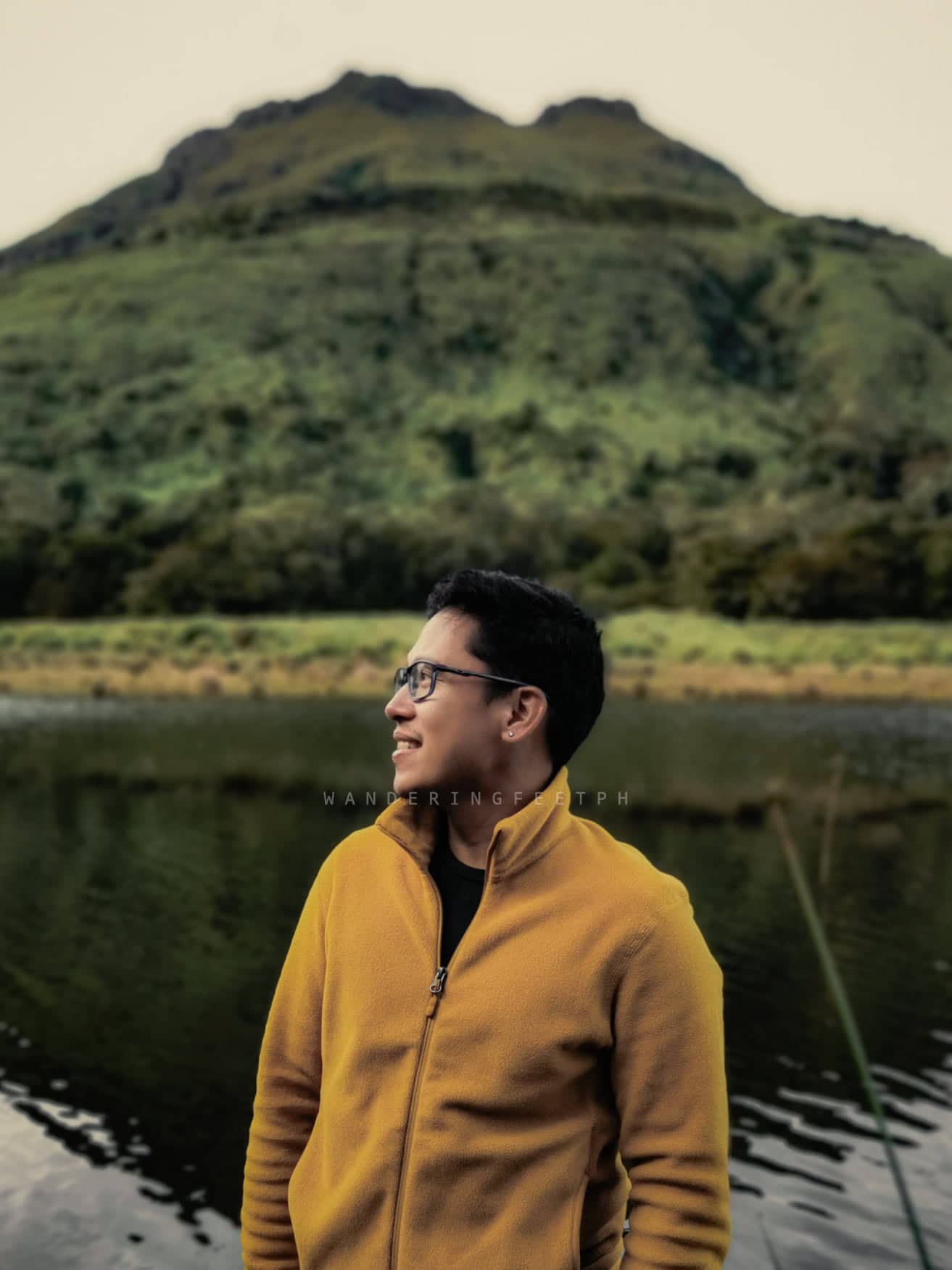
Talking about the morning after, nothing beats waking up to a cold morning and the first thing to capture your eyes is the beautiful Mt. Apo with its bare beauty. Top that with its magnificent reflection from the waters of Lake Venado. Surreal! For sure, one of the best views I had in my entire life. As the sun slowly appeared from the horizon, the golden glow of Mt. Apo put me into a hypnotic reverence for the mountain. The clear blue skies accentuated the view while the lake’s water reflected the overall landscape. It was as if a fantasy on canvass turned reality. We did not miss taking photos of the scene.
As the day progressed, we started breaking our camp at around 8:00AM and started our descent around 8:30AM. The trek was estimated to last for 7 hours passing through the Century Tree.
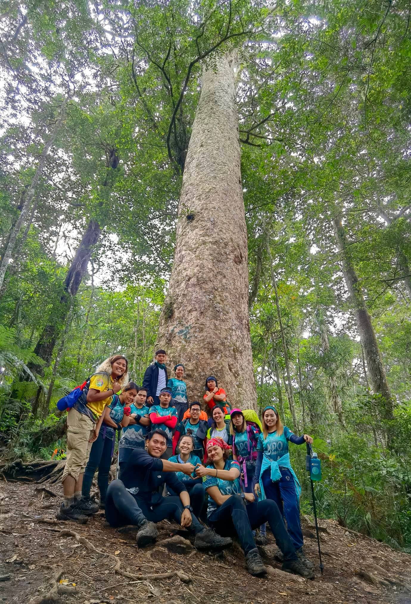
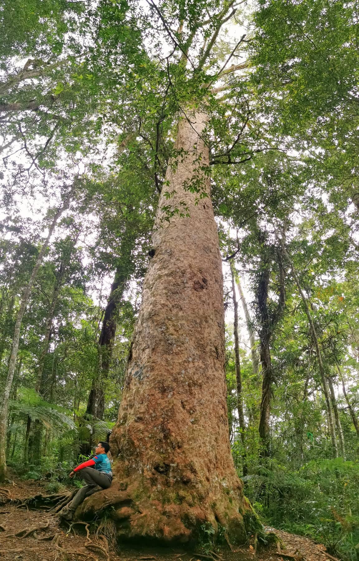
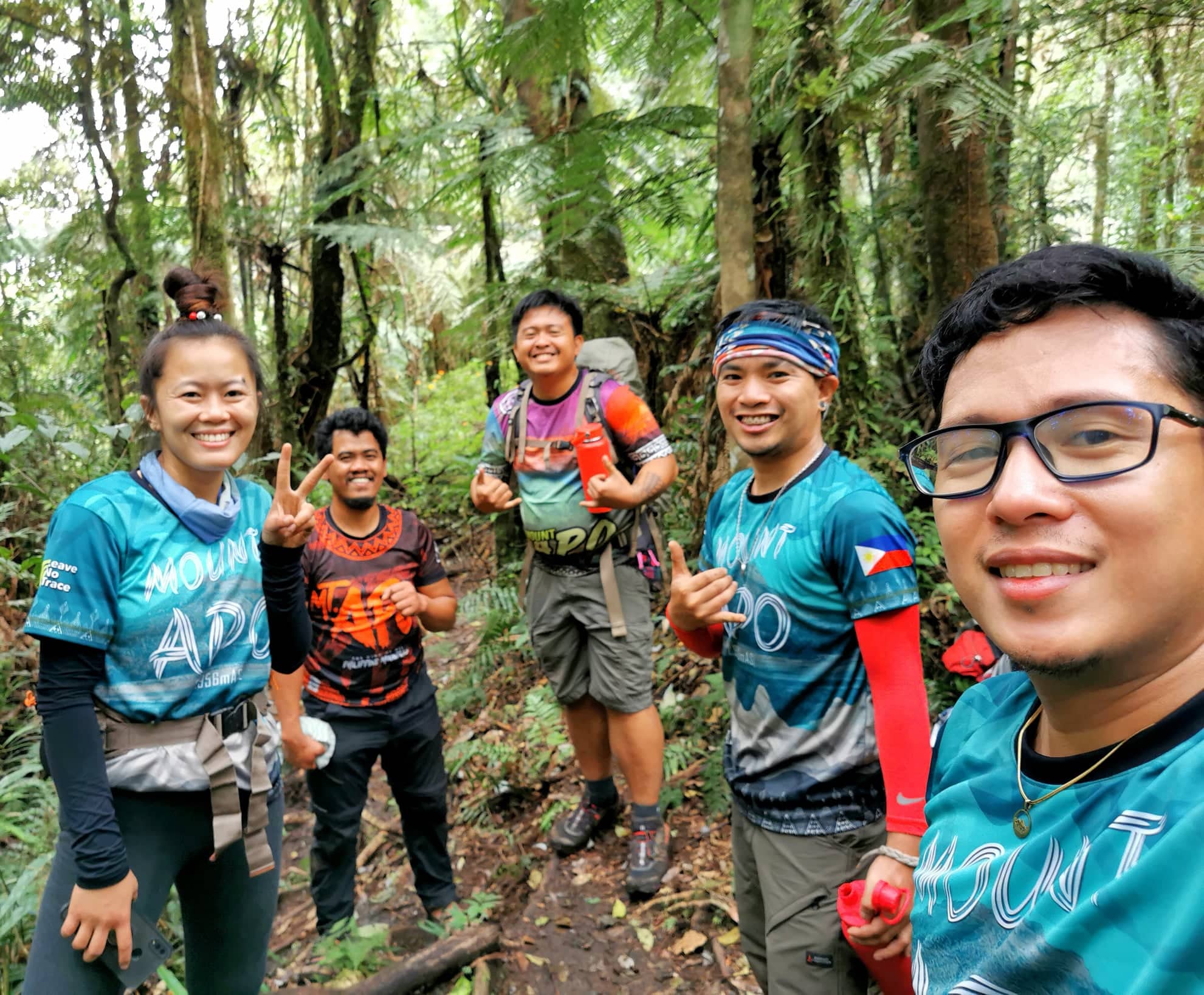
It took us around 3 hours to arrive at the Century Tree where we stayed for a while and took our lunch. As the area started to get cramped up with other climbers arriving for a rest, we headed right away and continued our descent by 12PM. Our guide, Kuya Babo, estimated around 4 hours more before arriving back at the jump-off area. We stopped several times to wait for the other members and regroup. Though the trail was mostly flat, the duration was almost exhausting.
Finally, after 2 hours, we arrived at the steep section said to be the last descent. There are ropes to guide climbers down as the height is really hypnotizing especially for those with a fear of heights. Seeing the tiny village from afar gave us the excitement to fasten our pace. Then, at last, we reached civilization. Time to relax while waiting for the others to arrive. I bought myself a cold drink and a snack at the nearby sari-sari store while resting my body until the others arrived around an hour after.
When we finally regrouped, we then headed straight down back to the jump-off area for another hour of trek. We arrived back at the jump-off area around 5PM where we got our climb certificates as proof of our achievement. Just right after we arrived, the sky poured down heavily with lightning and thunder as if congratulating us for the feat achieved. We were actually congratulating each other at the jump-off area. I was actually feeling mixed emotions at the jump-off area. I was happy to finally unlocked Mt. Apo but was a bit sad that the adventure has finally come to a conclusion. It truly is about the journey and not the destination. I just stared at the misty mountains and absorbed the feelings to sink into my memory bank.
Though we still have a distance to cover from the jump-off area back to the plains where our chartered van would fetch us. We did not hold back Kuya Babo a bit longer as he still has other important matters to attend to that day. We continued our trek down under the rain down to the highway. Luckily the rain stopped and we were able to change to our dry clothes before the van arrived. It was already dark when the driver came to fetch us. Thankfully, the driver knows how to step on the gas as it did not take us a lot of time to arrive from Digos City to Davao City where we rented an apartment for our rest prior to our flight back.
NOTES AND REMINDERS
- Listen attentively when orientation is given.
- Never litter. Be a good example of a mountaineer. Leave no trace.
- Bring the necessary amount of toiletries. You might be spending several days with no shower.
- Bring enough potable water for consumption for several days. Especially if you have a sensitive stomach and cannot adapt to natural waters in the mountain.
- If you have a sensitive stomach, better be prepared with OTC medications like loperamide.
- Bring extra batteries for your gadgets and flashlights.
- When camping, make sure to pack even the tiniest bit of trash and bring it with you when leaving the campsite.
- Respect wildlife and territories!
- Lastly, enjoy and appreciate what the mountain can offer.
- Remember that this is not a race of whoever gets at the peak first.
- Don’t forget your souvenir pictures.
- Surely, you’ll gain friends, self-trust, and self-reliance by the end of the adventure.


is mt kalatungan more difficult than mt apo sir?
LikeLike
both are challenging, but I can say the boulders section of Mt. Apo really demands more stamina.
LikeLike
I’ve been to both.. almost the same, but for me, Kalatungan was more challenging because we climbed the traverse in just 2 days and medyo late na nagstart.
But it also depends on the trail. I’ve tried the Mt. Talomo – Mt. Apo Traverse, and I will never do it again.
LikeLike